Watto
Watto
History of Watto
Watto, a region steeped in history and conflict, lies on the tumultuous continent of Beluaterra. These lands have a rich history, and no one man could tell it all. The bloody conflicts that occurred here between Vlaanderen and Heen were not the first, nor will they be the last. Religious turmoil has also swept the region now and then, and overall, the very nature of the region is to be torn between two powers, be it geographically, politically, religiously, or by any other means. This no-man's land is a buffer, the border, and is better defined by what it is not than by what it is.
Nestled on the border between the powerful realms of Nothoi and Irondale, Watto has currently experienced a number of years of stability and peace after the fall of Caelum during the Sixth Invasion.
Description of Watto
The dry badlands of Watto serve as a form of buffer between the lifeless deserts in the west and the fertile farmlands in the east.
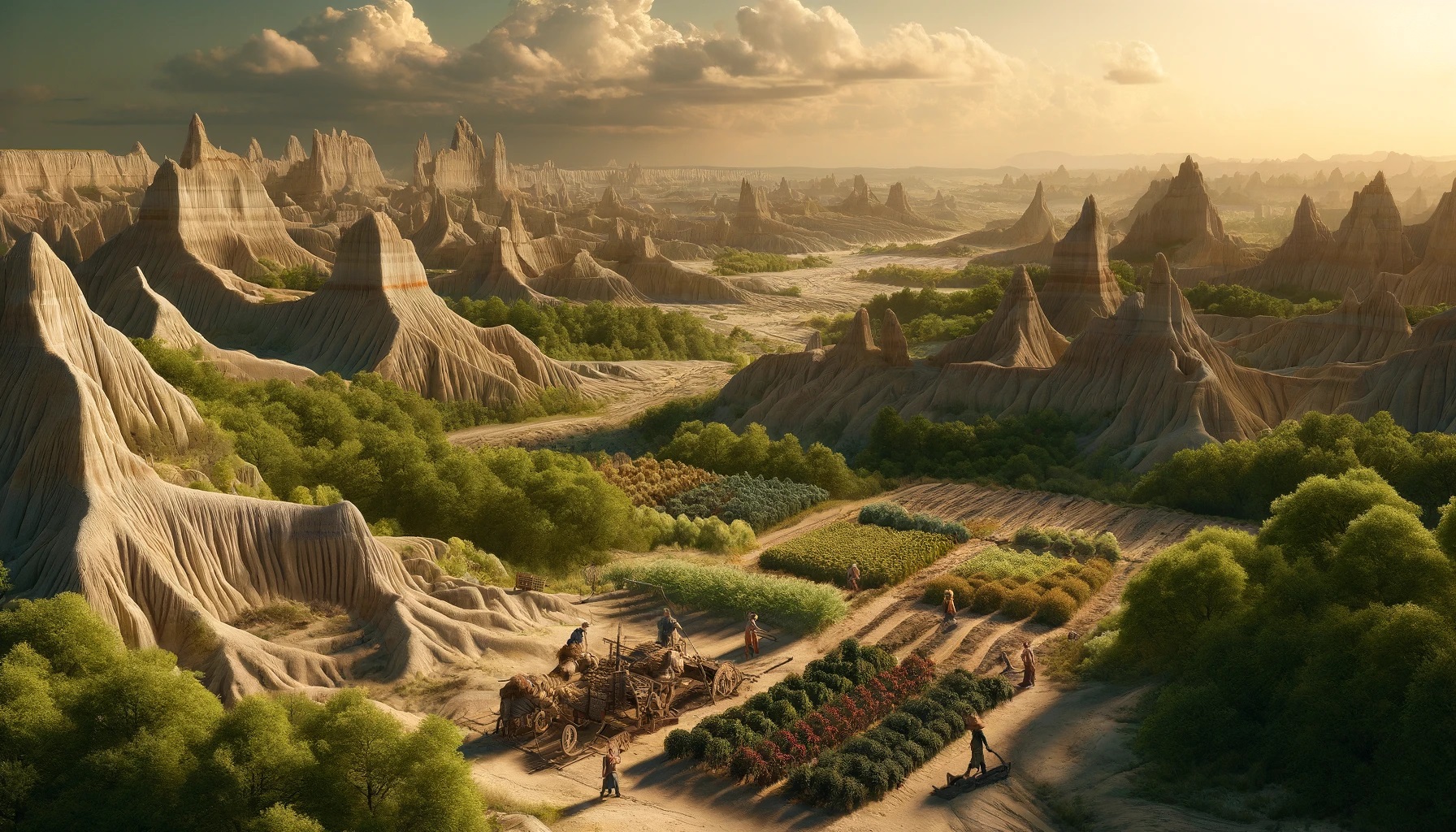
Watto is a region characterized by a diverse and dramatic landscape, shaped by both natural forces and centuries of human conflict. The terrain is a tapestry of rugged beauty and fertile promise, interspersed with reminders of its turbulent history.
At its heart, Watto features a series of eroded buttes, pinnacles, and spires that rise sharply from the ground, creating a maze of rocky formations. These natural towers, sculpted by wind and water over millennia, dominate the skyline and offer breathtaking views of the surrounding lands. The ruggedness of this central area serves as a natural fortress, making it a strategic location during times of war.
Surrounding these rocky outcrops, the land gradually slopes into rolling hills and wide valleys. These areas are more hospitable and have become the agricultural heartland of Watto. The soil, enriched by ancient riverbeds, is surprisingly fertile, allowing for the cultivation of hardy crops such as wheat, barley, and root vegetables. Small farms and fields dot the landscape, their orderly rows a stark contrast to the wild beauty of the central badlands.
A network of rivers and streams crisscrosses Watto, providing much-needed water to the farmlands and forming natural boundaries between different areas. These waterways, fed by seasonal rains and mountain runoff, support a variety of plant life along their banks. Willows, alders, and hardy shrubs thrive here, creating green corridors that are a lifeline for both humans and wildlife.
To the east and west, the terrain becomes increasingly arid, hinting at the encroaching desert. Sandy dunes and dry riverbeds begin to appear, marking the transition from fertile farmland to the harsh, barren expanses beyond. The desert is a constant reminder of the precarious balance of life in Watto, where prosperity is always at the mercy of the elements.
The region's villages and towns are nestled within the more hospitable valleys and along riverbanks. These settlements are fortified, with stone walls and watchtowers providing protection against both human invaders and the roving bands of daimon, undead, and monsters that plague the land. The architecture is practical and robust, built to withstand sieges and the test of time.
The skies above Watto are often a brilliant blue, with the weather shifting dramatically between seasons. Summers bring scorching heat and occasional droughts, while winters can be harsh, with freezing winds sweeping down from the northern mountains. Spring and autumn are more temperate, bringing life-giving rains and a burst of color as wildflowers bloom across the hills and valleys.
Overall, Watto's landscape is one of stark contrasts and resilient beauty. It is a land shaped by conflict and survival, where the scars of the past blend seamlessly with the promise of the future. The physical layout of Watto reflects its history—a region caught between extremes, yet full of potential for those strong enough to tame it.
Estates of Watto
- Eastern Watto
- Western Watto


