File:War Islands Map.png
Revision as of 16:57, 12 February 2011 by Fury (talk | contribs) (uploaded a new version of "File:War Islands Map.png")
Size of this preview: 720 × 600 pixels. Other resolutions: 288 × 240 pixels | 789 × 657 pixels.
Original file (789 × 657 pixels, file size: 960 KB, MIME type: image/png)
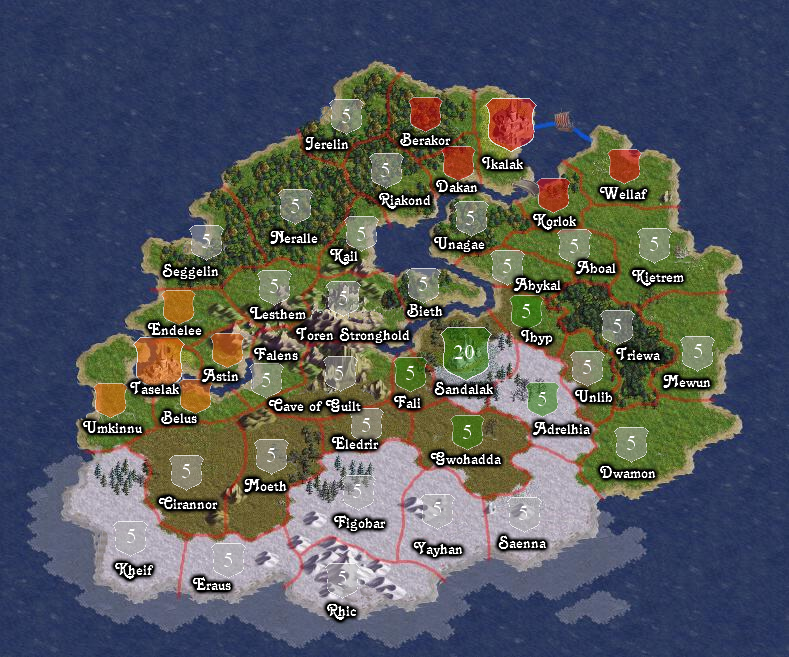
War Islands Map (with icons).png by User:Fury
It's my take on making the names & colour clearer etc.
File history
Click on a date/time to view the file as it appeared at that time.
| Date/Time | Thumbnail | Dimensions | User | Comment | |
|---|---|---|---|---|---|
| current | 16:57, 12 February 2011 | | 789 × 657 (960 KB) | Fury (talk | contribs) | |
| 15:34, 30 January 2011 | 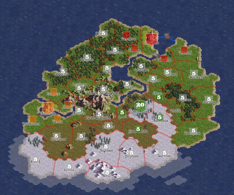 | 789 × 657 (1.1 MB) | Fury (talk | contribs) | War Islands Map (with icons).png by User:Fury It's my take on making the names & colour clearer etc. |
- You cannot overwrite this file.
File usage
There are no pages that use this file.