Maps
Here are the maps of the BattleMaster continents. There are two basic types of maps for each island, Full and Geographical. Full has borders and regions names; Geographical has only the geography of the island. There is also a history section for each island that contain a directory of maps and a time-lapse video of the island. All maps in the history section contain realm information. The directories contain a snapshot of an island for each turn starting from the last half of 2012 and until present day.
Please download the images that are listed as JPG through right-click instead of repeatedly viewing them, because some of them are large and cause unnecessary traffic.
Contents
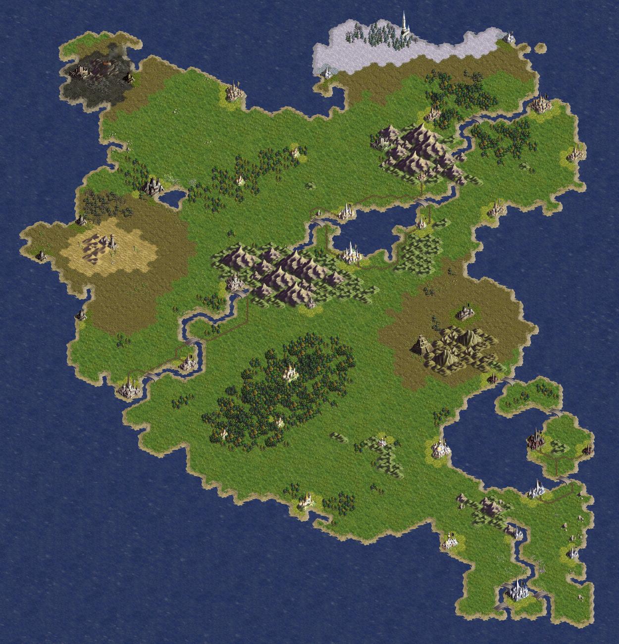
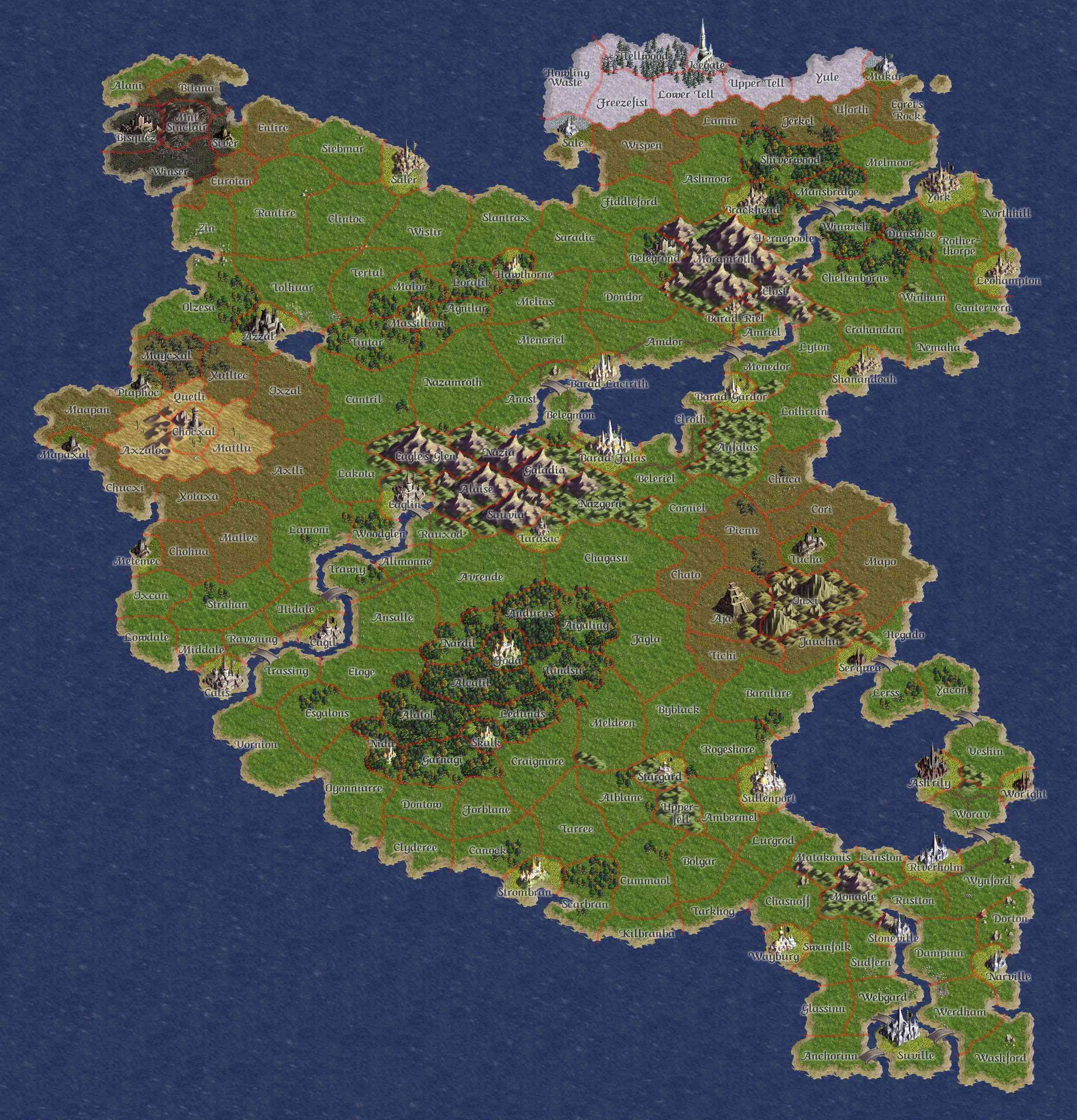
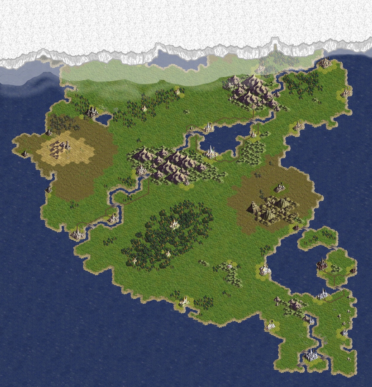
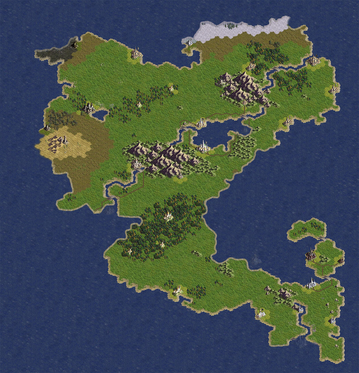
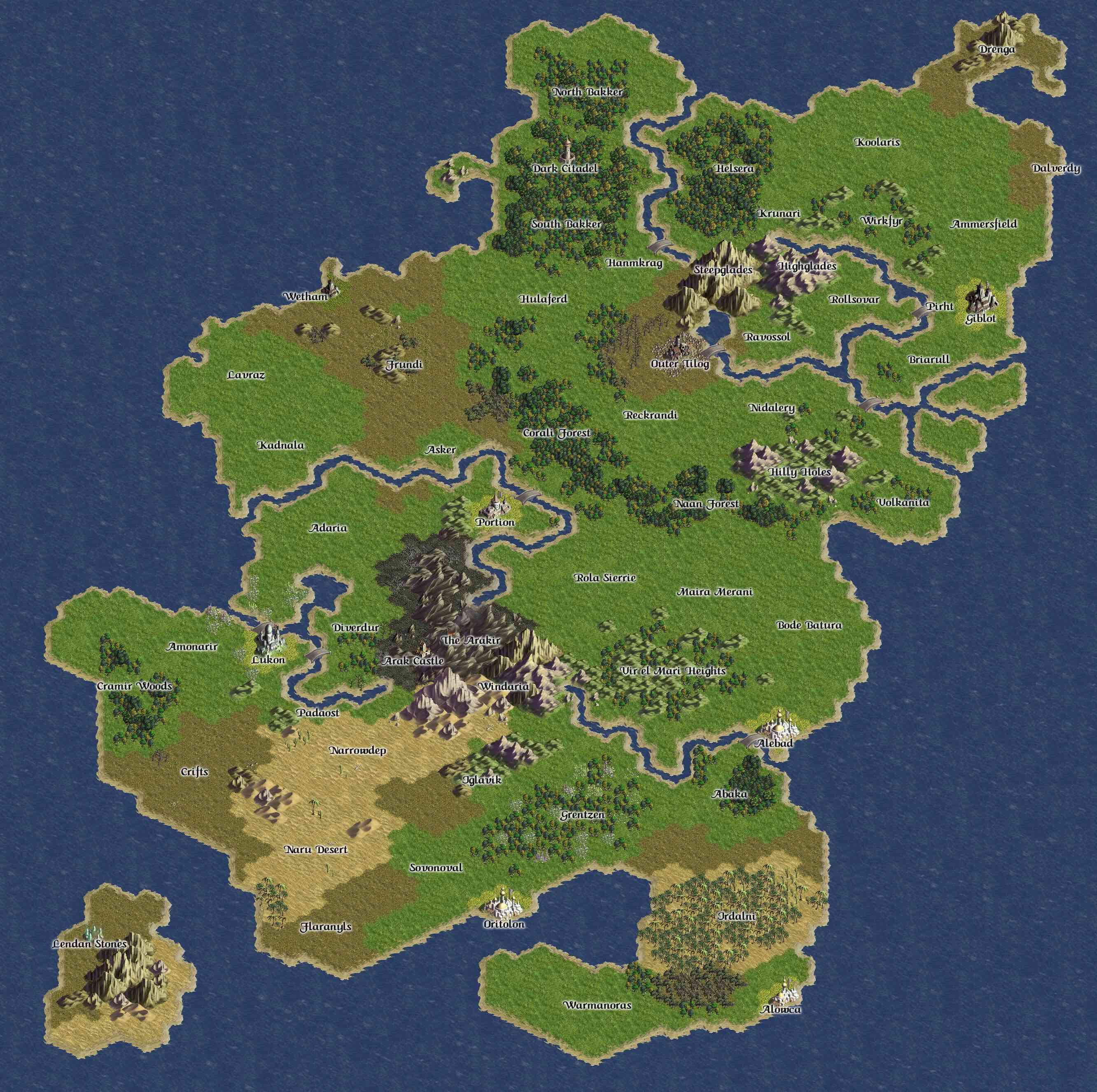
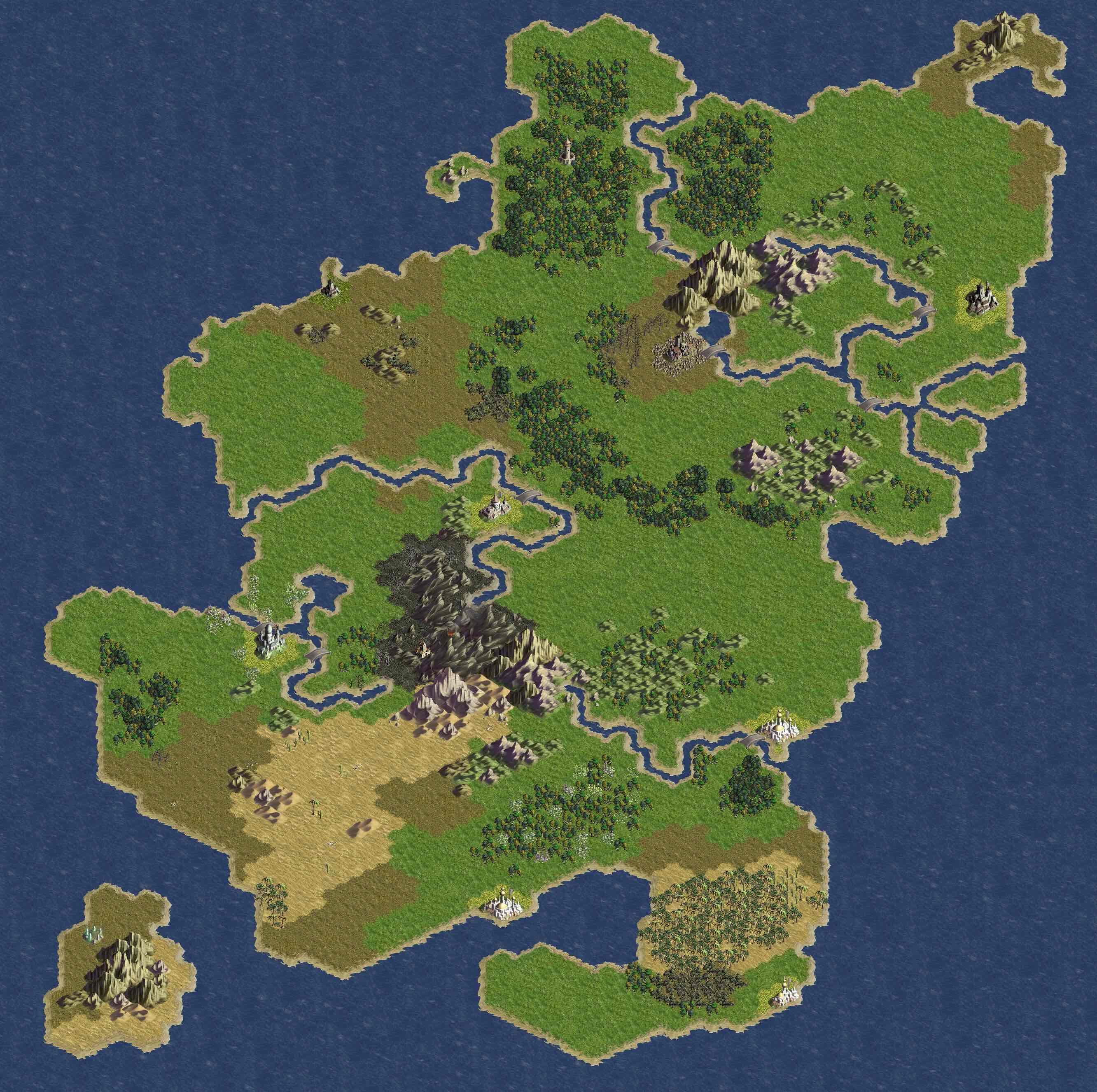
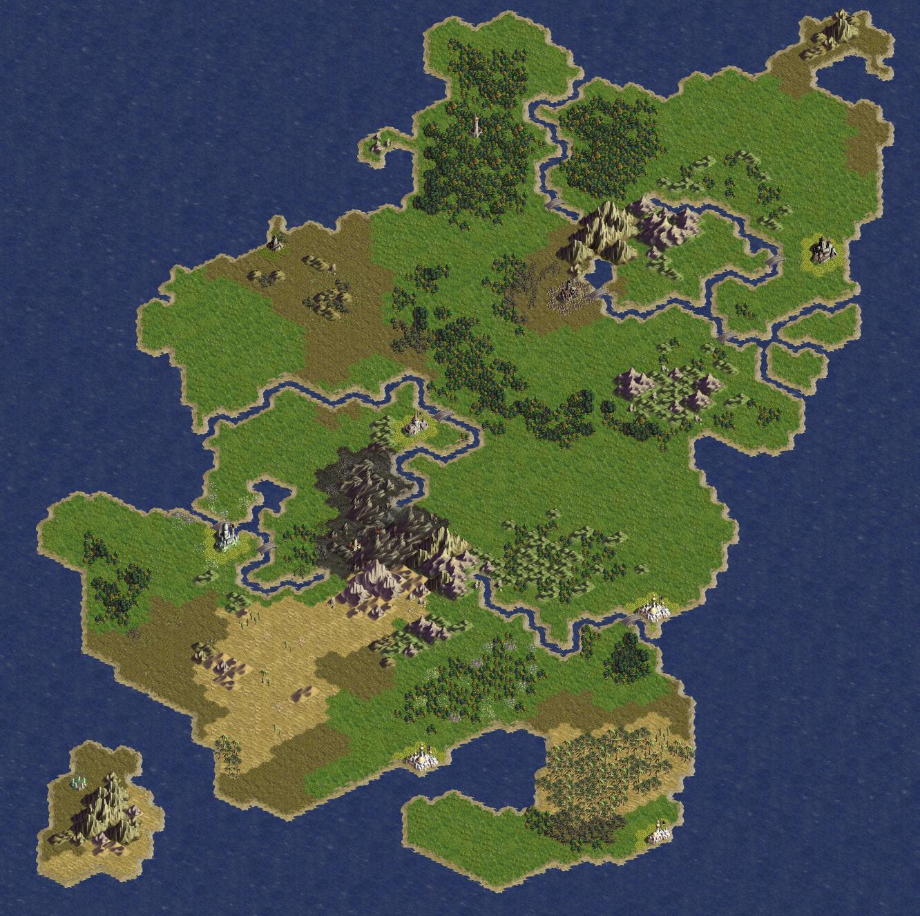
Atamara
Main article: Atamara.
History
Beluaterra
Main article: Beluaterra.
The map of Beluaterra changed after the Fourth and Fifth Invasions in the fight against the daimons. The event that led to the change is known as the blight.
History
- Historical Directory of Beluaterra
- Beluaterra Time-Lapse from 2005 to 2011
- Beluaterra Time-Lapse from 2012 to 2018
- GIF of the Sixth Invasion (Wiki-file)
- Political Map of 19-3-10 (Wiki-file)
Colonies
Main article: Colonies
History
- Historical Directory of the Colonies
- Colonies Time-Lapse from 2005 to 2012
- Colonies Time-Lapse from 2012 to 2018
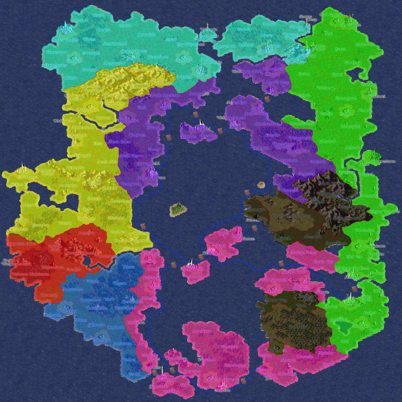
Dwilight
- Full Map - Full-size map with region names and borders. (1.6 MB)
- Small Map - Smaller map with region names and borders. (368 KB)
- Political Map - Last recorded political map. (379 KB)
- Historical maps. These are the original working layouts, and do not reflect the final geography of the island.
- Geographical Map (Original Ver.) - Full-size map, geography only. (1.6 MB)
- Small Geo Map (Original Ver.) - Smaller geographic map. (311 KB)
- Miscellaneous maps used during the construction of the island and it's databases.
- Region ID Map - Full-size map showing the ID number for each region. (1.6 MB)
- Weather Area Map - Small-size map showing boundaries between weather areas. (704 KB)
East Continent and Far East
- Full Map - Full-size map before the Bad Tidings with region names and borders. (1.3 MB)
- Geographical Map - Full-size map before the Bad Tidings, geography only. (1.3 MB)
- Full Map - Full-size map with region names and borders. (1.3 MB)
- Geographical Map - Full-size map, geography only. (1.3 MB)
- Small Map - Smaller map with region names and borders. (292 KB)
- Small Geo Map - Smaller geographic map. (272 KB)
- Political Map - Last recorded political map of East Continent. (358 KB)
- Political Map - Last recorded political map of the Far East Island. (365 KB)
-Large-Details.jpg)
-Large-Geo.jpg)
South-East Island and South-West Island
The islands have been sunk into the sea, but the maps remain and have since been utilised in BattleMaster:War Islands.
- Small Map - Smaller map with region names and borders. (941 KB)
- Small Geo Map - Smaller geographic map. (961 KB)
- Southern Islands Regions - Slightly larger map, with region names and borders.
SpellMaster Era
- Full Map - Full-size map with region names. (1.2 MB)
Videos
In August 2012, Tom began posting videos showing the history and changes to the various continents using a depository of map data going back seven years.