File:Atamara Modern Pop Density.jpg
Jump to navigation
Jump to search

Size of this preview: 576 × 599 pixels. Other resolutions: 231 × 240 pixels | 1,250 × 1,300 pixels.
Original file (1,250 × 1,300 pixels, file size: 118 KB, MIME type: image/jpeg)
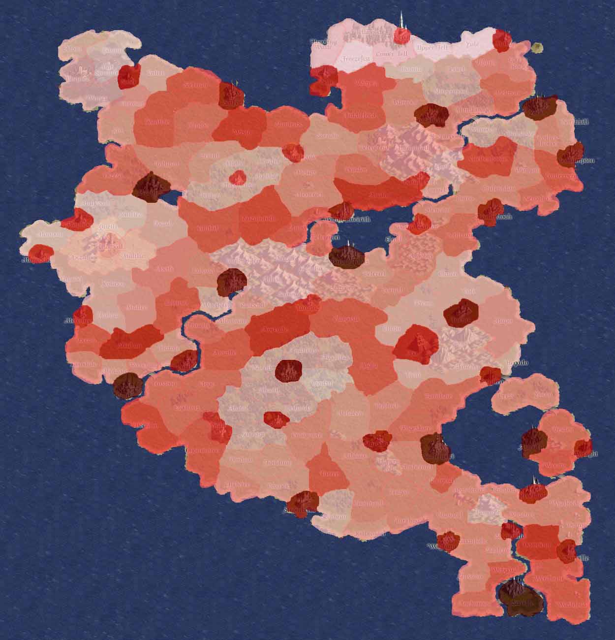
This is a map showing the geographic breakdown of Atamaran population. The darker the region, the more people dwell there. While it does not present a perfect picture of population density, it does give a good impression of where the centers of population are and, when compared to the trade route maps, gives an interesting picture. Also, if this map is compared to the ancient languages map, it also gives an interesting correlation.
File history
Click on a date/time to view the file as it appeared at that time.
| Date/Time | Thumbnail | Dimensions | User | Comment | |
|---|---|---|---|---|---|
| current | 04:46, 24 September 2006 | | 1,250 × 1,300 (118 KB) | Vellos (talk | contribs) | This is a map showing the geographic breakdown of Atamaran population. The darker the region, the more people dwell there. While it does not present a perfect picture of population density, it does give a good impression of where the centers of population |
- You cannot overwrite this file.
File usage
There are no pages that use this file.